Photogrammetry
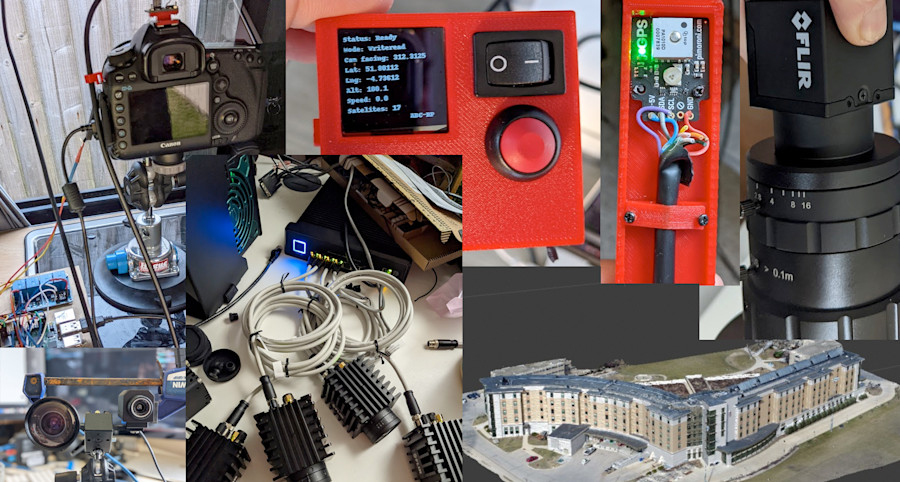
I created a photogrammetry rig that uses GPS and accelerometer to take photos as set distance intervals to create a photo set for photogrammetry. The final system took RGB and thermal images of houses with a view to calculating heat loss from homes at scale. I combined the final images with a machine learning tool to work out the X and Y pixel locations of windows, doors etc which were then layed over the thermal version of the image to calculate the temperatures. The system is fairly complex, but im happy to chat over this.
The base of the system was a Docker container stack which used Python and the Flir SDK for controlling the thermal camera. We used 10gig ethernet to capture 30 x 45 megapixel images a second.